
Underground FTTH and right-of-way permit design
A municipal broadband prime contractor preparing phased underground FTTH permit packages across Northern Colorado Front Range communities.
- Input received
- A survey/design base with right-of-way and property lines, composite utility records with source date and confidence notation, roadway-owner jurisdiction and permit checklists, and the client's duct, handhole and spare-conduit criteria.
- Delivered
- Jurisdiction-indexed permit plan sets, a conduit/cable/handhole/bore schedule register, a GIS line/point package, a composite utility-conflict log, route-segment quantities and BOM, and a QA/revision/permit transmittal matrix.
- Timeline
- 21 business days after receipt of the approved base, utility composite and jurisdiction checklist.
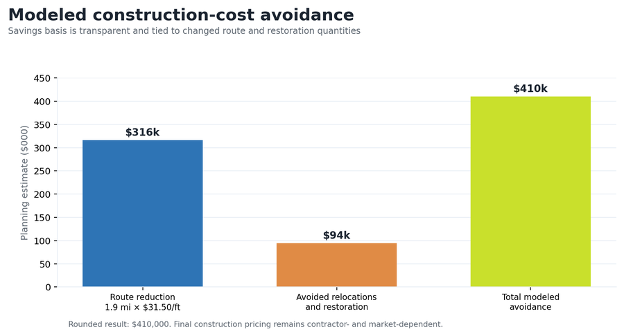
One connected network model is divided into nine jurisdiction-specific permit packages. The modeled design resolves 51 of 64 identified utility conflicts before permit issue, shortens the initial route by 1.9 miles, and the revised quantities indicate approximately $410,000 in avoided construction and restoration cost relative to the seed alignment.
- Underground route
- 26.8 mi
- Bore crossings
- 42
- Permit sets
- 9
- Modeled savings
- $410k
The engineering problem
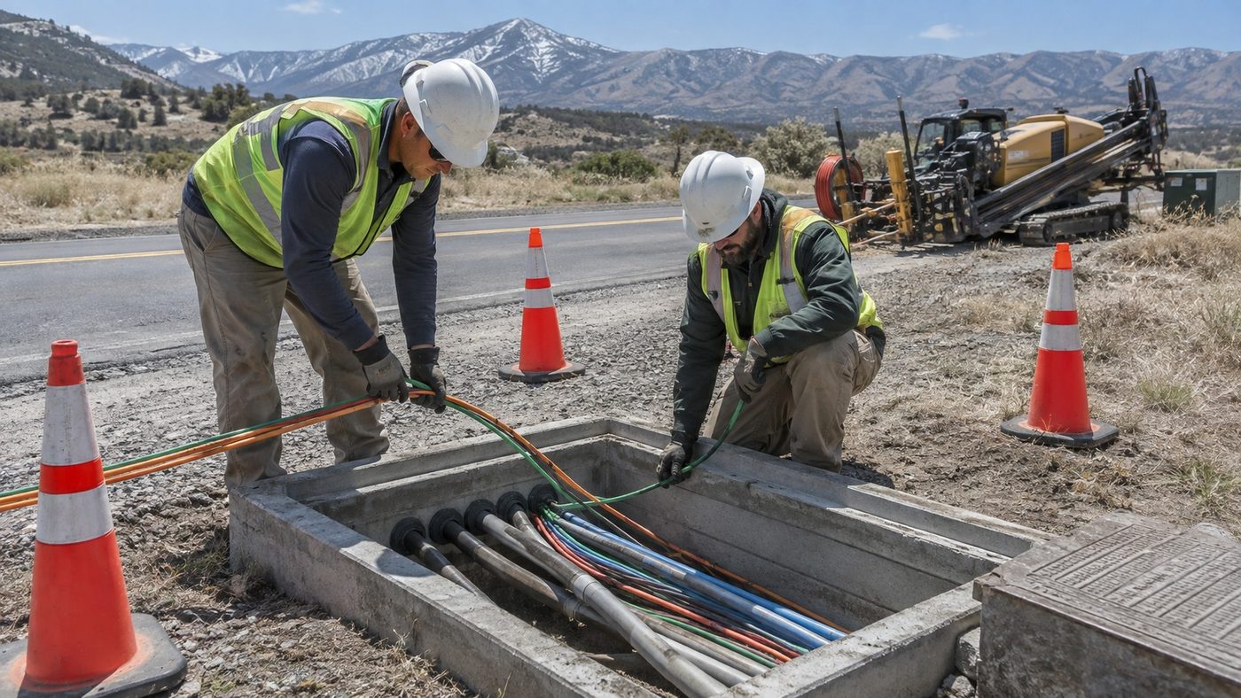
The build passes established subdivisions, commercial frontage and state-highway approaches where water, sanitary, storm, gas, electric and incumbent telecom records overlap. Available utility records carry different survey dates and quality levels, and several candidate handholes fall within driveways, drainage features or landscape zones. The permitting problem is to create jurisdiction-specific packages without fragmenting the network model: every reroute, bore-length change and handhole move must update the plan sheets, GIS, bore schedule, restoration quantities and BOM together, from the same controlled segment IDs.
Design parameters and first-principles checks
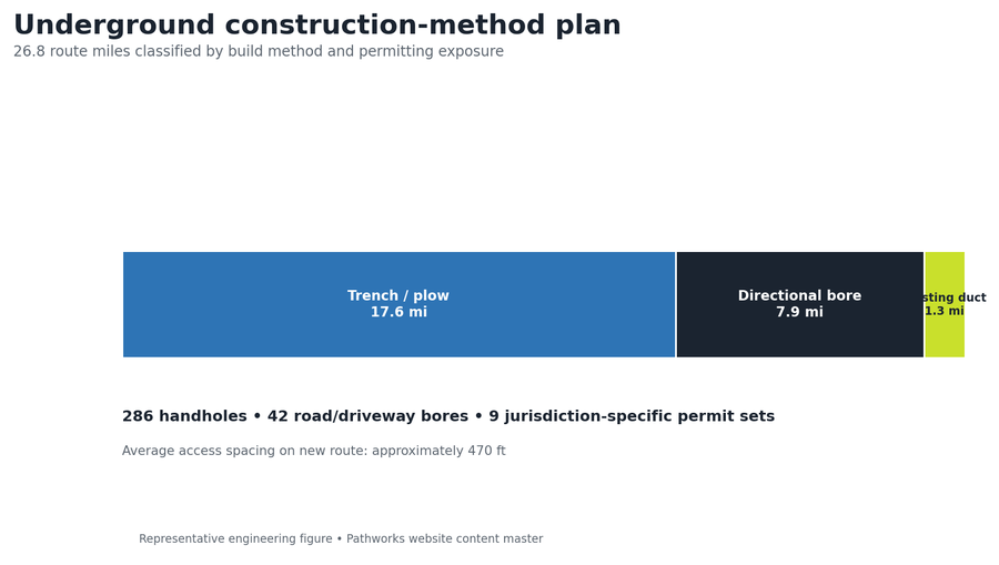
| Underground route | 26.8 miles total: 17.6 mi trench/plow, 7.9 mi directional bore, 1.3 mi existing duct |
|---|---|
| Structures | 286 handholes; approximately 470 ft average access spacing on 25.5 mi of new route |
| Crossings | 42 road/driveway bore profiles and schedules |
| Jurisdictions | Nine permit packages across municipal, county and state roadway owners |
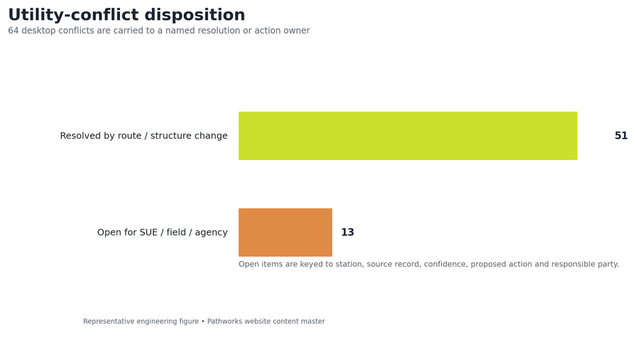
| Utility conflicts | 64 desktop conflicts; 51 resolved by route/structure change; 13 carried to SUE/field/agency action |
| Route optimization | Seed alignment reduced by 1.9 miles |
| Modeled avoidance | $316k route reduction + $94k relocations/restoration = approximately $410k |
Key design decisions
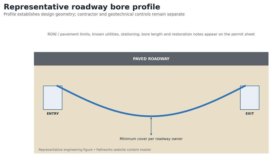
Composite utility records are used with source date and confidence status; record linework is never presented as survey-quality evidence. Handholes are moved away from driveways, drainage features, curb ramps and high-restoration surfaces before permit issue where the network geometry allows. Bore profiles are prepared for permit geometry and known constraints while final tooling, fluids, pullback and geotechnical design are left to the construction team and qualified specialists. One segment ID is carried from GIS through plan callout, permit sheet, quantity row and conflict entry so revisions propagate consistently.
Permit-package matrix
| Roadway owner / area | Packages | Route mi | Bores | Primary drawing controls |
|---|---|---|---|---|
| City North | 3 | 8.2 | 14 | ROW line, pavement cut, sidewalk/ADA, restoration |
| County corridors | 2 | 10.4 | 13 | ditch profile, driveway crossings, shoulder restoration |
| State highway approaches | 2 | 4.8 | 9 | stationing, bore profile, cover, traffic-control reference |
| Adjacent municipalities | 2 | 3.4 | 6 | local title block, details, permit quantities |
| TOTAL | 9 | 26.8 | 42 | One network model; jurisdiction-specific issue sets |
Construction-method and quantity control
| Method / asset | Quantity | Design control |
|---|---|---|
| Trench / plow | 17.6 mi | Segment method, surface type, duct count and restoration category |
| Directional bore | 7.9 mi | Bore ID, station limits, profile, owner, cover and known-utility notes |
| Existing conduit reuse | 1.3 mi | Owner evidence, duct availability and rodding/proofing requirement |
| Handholes | 286 | ID, size, station, surface, jurisdiction and connected segments |
| Bore crossings | 42 | Entry/exit, bore length, crossing type and permit sheet reference |
| Open conflicts | 13 | Location, source confidence, action, responsible party and issue status |
QA steps and evidence
| QA gate | Acceptance test | Evidence / result |
|---|---|---|
| ROW model | Route and structures inside mapped permit limits | Jurisdiction and property/ROW overlay check |
| Duct continuity | No orphan segments; pulling sections within client criteria | Segment-to-handhole trace and length report |
| Crossings | All road/driveway bores carry profile and schedule ID | 42 bore IDs reconcile to sheets |
| Utilities | Every conflict has source, response and action owner | 51 resolved; 13 open |
| Permit completeness | Title block, notes, details, restoration and quantities match owner checklist | Nine signed internal QA checklists |
| Quantity | GIS, schedules, sheets and BOM match | 26.8 mi / 286 handholes / 42 bores |
Revision record
| Revision | Trigger | Change made | Controlled outcome |
|---|---|---|---|
| R0 | Composite utility review | Moved 31 handholes and rerouted 1.4 mi | Forty-four conflicts closed; dependent schedules and quantities updated |
| R1 | Agency checklist review | Adjusted six bore limits, restoration notes and 0.5 mi of alignment | Nine owner-specific permit sets released; 13 external actions retained |
Result and calculation trail
The modeled design resolves 51 of 64 identified utility conflicts before permit issue, shortens the initial route by 1.9 miles and packages the work into nine jurisdiction-specific sets. The revised quantities indicate approximately $410,000 in avoided construction and restoration cost relative to the seed alignment.
Route reduction: 28.7 seed miles − 26.8 final miles = 1.9 miles. Route savings: 1.9 mi × 5,280 ft/mi × $31.50/ft = $316,008. Avoided relocation/restoration allowance: approximately $94,000. Total modeled avoidance: $316,008 + $94,000 = $410,008, reported as approximately $410,000.
Pathworks developed 26.8 miles of underground FTTH design and divided the coordinated network into nine permit-ready packages: conduit routing, 286 handholes, 42 bore crossings, composite utility review, restoration quantities and a controlled exception log.
More case studies

Greenfield FTTH design for 500 homes, full OSP package from plat to BOM
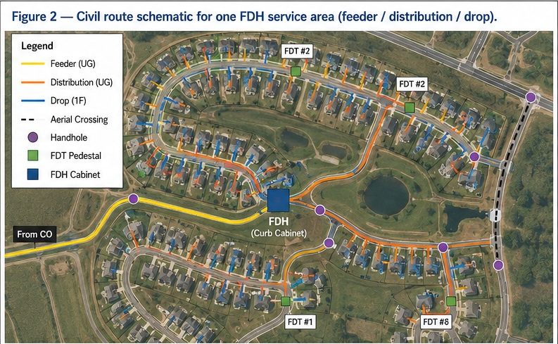
Built to standard US ILEC/CLEC practice: a two-stage 1:4/1:8 split localizes fault response to a single FDT instead of the whole feeder, construction runs underground-first to meet HOA aesthetic requirements, and 20–30% spare fiber is held at every tier so the network can absorb infill lots without a re-trench. The design closes with 7.4 dB of optical margin against the 28 dB GPON Class B+ budget, enough headroom for a future 1:64 upgrade at a subset of FDTs.
Rural greenfield FTTH design for a 500-location BEAD service area
A two-stage 1:32 split architecture assigns all 500 approved locations to complete XGS-PON paths across 512 terminal ports. Route optimization reduces the seed alignment from 35.7 to 33.0 miles, a 7.6% reduction, while the modeled planning cost falls from $9,460 to $8,940 per passing and the worst modeled path retains 4.74 dB of N2 optical margin.
Aerial FTTH design and pole make-ready analysis
A pole-by-pole evidence record separates clean attachment candidates from conditions that require transfer, rearrangement, guying review or replacement. The modeled review identifies 226 make-ready or data conflicts across 1,946 poles; design adjustments resolve 141 before application packaging, including 15 avoided pole-replacement candidates, reaching 92% first-submission readiness.