
Aerial FTTH design and pole make-ready analysis
A regional fiber overbuilder expanding through mixed investor-owned and cooperative pole territories across North Georgia suburban and rural corridors.
- Input received
- A pole survey export with coordinates, owner, height/class/species and condition data, measured communication attachments, span lengths and mid-span photos, and pole-owner application templates and batch limits.
- Delivered
- Aerial route plan sheets, a pole schedule with existing/proposed heights and dispositions, a photo index and missing-data report, a make-ready matrix, an owner-format pole-loading input workbook, and an attachment application drawing set.
- Timeline
- 18 business days after receipt of a complete survey export and owner criteria.
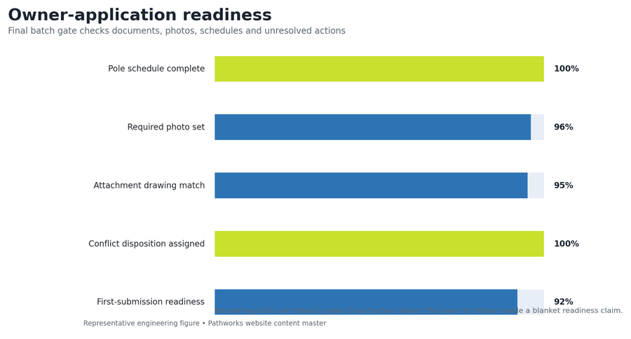
A pole-by-pole evidence record separates clean attachment candidates from conditions that require transfer, rearrangement, guying review or replacement. The modeled review identifies 226 make-ready or data conflicts across 1,946 poles; design adjustments resolve 141 before application packaging, including 15 avoided pole-replacement candidates, reaching 92% first-submission readiness.
- Poles analyzed
- 1,946
- Aerial route
- 61.3 mi
- Conflicts found
- 226
- Turnaround
- 18 days
The engineering problem
The route crosses three pole-owner territories and includes older joint-use lines where pole tags, attachment ownership and measured heights are not consistently recorded. Some spans exceed the client's preferred length, several road crossings lack complete lowest-point measurements, and vegetation or equipment obscures field photographs. The objective is to separate clean attachment candidates from conditions that require transfer, communication-space rearrangement, guying review, replacement or structural analysis, rather than burying every exception inside a generic make-ready allowance. The work is organized around a pole-by-pole evidence record: clean poles move directly into owner application batches, while incomplete, conflicting or structurally sensitive poles stay on a named exception path.
Design parameters and first-principles checks
| Route | 61.3 aerial miles across 1,946 poles; average sequential span approximately 166 ft |
|---|---|
| Premises | 2,410 planned passings |
| Ownership | Three pole-owner territories with separate schedule and exhibit rules |
| Conflict population | 226 make-ready or data conditions; 11.6% of analyzed poles |
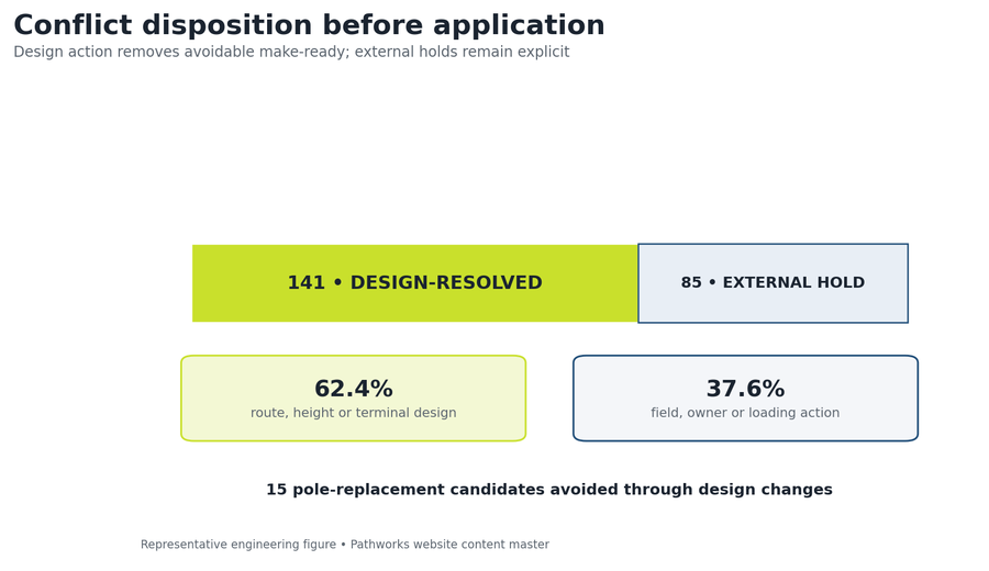
| Design-resolved | 141 conditions addressed through route, height, terminal or slack-location changes |
| External action | 85 conditions assigned to field recheck, pole owner or licensed loading analysis |
| Application readiness | 92% first-submission readiness against the representative owner checklist |
| Avoided redesign | 15 pole-replacement candidates removed through design changes before application |
Key design decisions
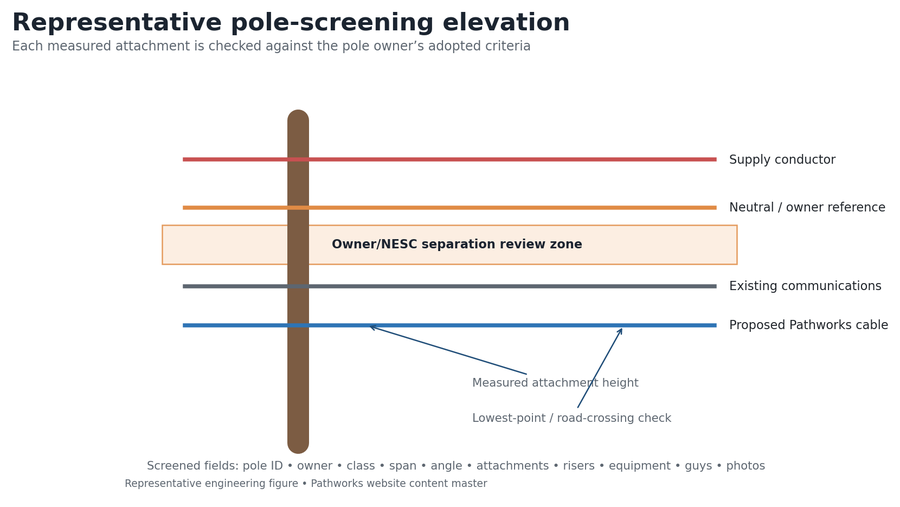
Each pole owner's adopted standards and templates are applied to its own territory; a single universal clearance or application rule is not assumed. Desktop screening identifies structural candidates, but screening is never represented as a licensed pole-loading certification. Conflicts are resolved by design where practical before owner batches are prepared, reducing preventable resubmittals and keeping remaining owner actions visible. Every application comment is tied to one pole ID, one sheet/schedule location, one disposition and one revision entry.
Pole-owner territory schedule
| Territory | Poles | Route mi | Flagged conditions | Application approach |
|---|---|---|---|---|
| Owner A | 742 | 23.4 | 88 | Four batches; owner CAD cover + pole schedule + photo index |
| Owner B | 668 | 21.1 | 76 | Three batches; PDF plan + loading-input export |
| Owner C | 536 | 16.8 | 62 | Three batches; joint-use worksheet + route exhibit |
| TOTAL | 1,946 | 61.3 | 226 | Ten controlled application batches |
Conflict classification and disposition
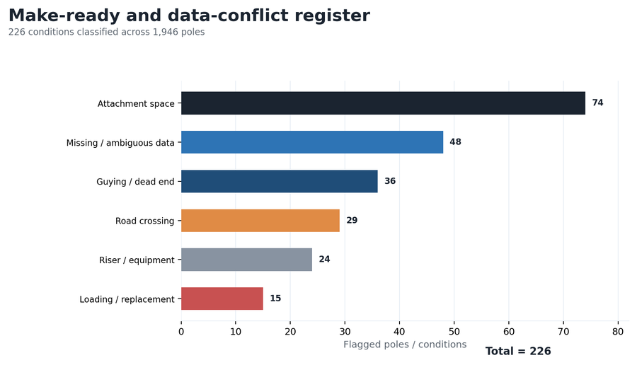
| Conflict class | Count | Typical Pathworks action | Residual owner |
|---|---|---|---|
| Attachment-space / height | 74 | Adjust proposed height, route or cable position where permitted | Pole owner for acceptance |
| Missing / ambiguous record | 48 | Issue pole-specific data request with photo/field reference | Survey / field team |
| Guying / dead end | 36 | Flag angle/tension case and prepare guying input | Owner / licensed engineer |
| Road-crossing clearance | 29 | Review measured height and route or attachment alternative | Owner / field verification |
| Riser / equipment | 24 | Shift attachment, slack or terminal and document equipment conflict | Pole owner |
| Loading / replacement | 15 | Prepare loading candidate record; redesign where practical | Licensed loading analysis |
QA steps and evidence
| QA gate | Acceptance test | Evidence / result |
|---|---|---|
| Inventory | Pole IDs, coordinates, sequence and ownership are unique | 1,946 poles reconcile across GIS, schedule and batches |
| Photo coverage | Required views indexed to pole ID | Missing/ambiguous images remain in the exception register |
| Clearance screen | Every crossing, riser, equipment pole, angle and dead end reviewed | 226 classified conditions |
| Loading inputs | Span, angle, cable and pole attributes complete for candidates | Candidate export plus missing-data flags |
| Application | Plan, pole schedule, photo and disposition match | Ten batch checklists; 92% first-submission readiness |
| Peer review | All conflict poles + statistical clean-pole sample | Reviewer initials and closed comment IDs |
Revision record
| Revision | Trigger | Change made | Controlled outcome |
|---|---|---|---|
| R0 | Route and terminal review | Moved 18 terminals, changed 37 proposed heights and rerouted 2.1 mi | 141 conditions closed through design |
| R1 | Owner-format review | Applied three owner title blocks, batch limits and loading fields | Ten application batches released; 85 external holds retained |
Result and calculation trail
The modeled review identifies 226 make-ready or data conflicts across 1,946 poles. Design adjustments resolve 141 before application packaging, including 15 avoided pole-replacement candidates. The final package reaches 92% first-submission readiness against the representative owner checklist; 85 poles remain explicitly assigned to field, loading or owner resolution.
Pole density: 1,946 poles ÷ 61.3 route miles = 31.7 poles/mile. Conflict rate: 226 ÷ 1,946 = 11.6% of analyzed poles. Design resolution: 141 ÷ 226 = 62.4% of flagged conditions closed before application. First-submission readiness: 92% against the complete representative owner checklist, with every hold named by pole ID.
Pathworks processed 1,946 pole records and designed 61.3 miles of aerial FTTH across three ownership territories, separating clean attachment candidates from 226 make-ready, data and loading conditions and carrying each disposition into pole schedules and owner-format drawings.
More case studies
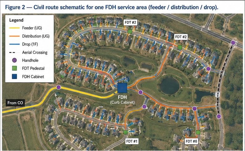

Greenfield FTTH design for 500 homes, full OSP package from plat to BOM
Built to standard US ILEC/CLEC practice: a two-stage 1:4/1:8 split localizes fault response to a single FDT instead of the whole feeder, construction runs underground-first to meet HOA aesthetic requirements, and 20–30% spare fiber is held at every tier so the network can absorb infill lots without a re-trench. The design closes with 7.4 dB of optical margin against the 28 dB GPON Class B+ budget, enough headroom for a future 1:64 upgrade at a subset of FDTs.
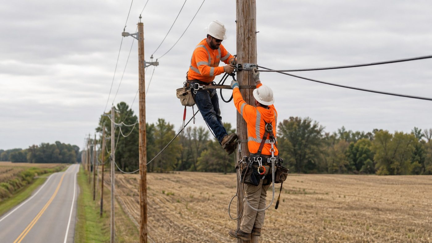
Rural greenfield FTTH design for a 500-location BEAD service area
A two-stage 1:32 split architecture assigns all 500 approved locations to complete XGS-PON paths across 512 terminal ports. Route optimization reduces the seed alignment from 35.7 to 33.0 miles, a 7.6% reduction, while the modeled planning cost falls from $9,460 to $8,940 per passing and the worst modeled path retains 4.74 dB of N2 optical margin.
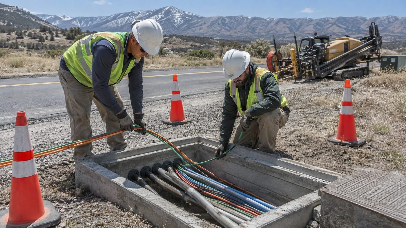
Underground FTTH and right-of-way permit design
One connected network model is divided into nine jurisdiction-specific permit packages. The modeled design resolves 51 of 64 identified utility conflicts before permit issue, shortens the initial route by 1.9 miles, and the revised quantities indicate approximately $410,000 in avoided construction and restoration cost relative to the seed alignment.